Location: Coyote Wall
State: Washington
Distance: 5.8 miles
Fees: None
Facilities: At trail head, none.
Scenery: Views of Columbia River Gorge, Mt. Hood, Coyote Wall and Labyrinth Falls
The day started out like all other Portland days: cloudy and early! Morgan and I peered out our windows hopeful that the clouds would clear out by the time we got to our destination. However, first stop: to pick up Liz!
Morgan had made delicious peanut butter oatmeal muffins for our breakfast on the 2 hour drive toward Klickitat county. On the way there, I realized that I was low on gas, so our trek on Hwy 14 became a nervous drive in search of a gas station. Ok, I was nervous. However, we were in luck. We came across our first gas station at North Bonneville. Not the cheapest, but cheaper than others. Not only that, since we were in Washington and Andrea is a pure bred Oregonian, it means she's never pumped her own gas...until now.
With our bladders emptied and the gas tank halfway filled (did I mention gas is expensive) onward we went.
After some beautiful views from our car, we reached the trailhead. But Morgan is no regular hiker. She found us a trail off the beaten path. We passed a cattle chute and walked along the river for a bit on old Hwy 8, a hwy now closed off to cars, (don't panic mom!) and of course the first obligatory planking shot done by yours truly.
And we found a lovely spot to pee before we started on our trek up.
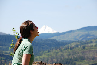
The trail was absolutely gorgeous. The weather couldn't be better. At first it started out a little windy, but as the sun heated the grass, it also heated our bodies. Everytime you turned around to see how far you'd gone, you'd be greeted with either the Columbia River or Mt Hood, with not a cloud in the sky, also, not even a soul around. Thank you Morgan for searching for a secluded trail!
You keep going straight on Hwy 8 and you'll pass the trail head of Coyote Wall, don't turn here:
This will actually be the end of our hike. Once we've reached this, we'll know we're done. Keep going another quarter mile to another trail head on the left. Start here. This is the begining of Labyrinth Loop, here:
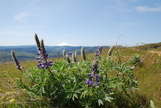
Right after the trailhead there will be one of many forks in the road, we are to take a right. It's a bit steep and rocky but its not long at all. After the top of the hill, just keep following the trail toward the waterfall and a small cave. There were some beautiful views...
..including Mt. Hood
We came back to the fork in the road to get back on the trail and go left up the steep ass hill! After that hill, which we must admit was pretty tough, you will come to a bridge over a little creek.
After the creek just follow the trail. The creek will be to your left. There will be a short rocky steep section. After that, keep following the trail up and you'll go through a little sparse forest and you'll have a cool rock formation on the right.
Next, just keep on the trail and there will be an option to walk down to a view point to the left, or you can stay on the trail to the right. It will curve back in away from the river toward the right. Then, it will come to a fork. Keep to the right. Now, be prepared because this is steep and long. It's hard. We were trying to sing the Christina Aguilera song "Fighter" for motivation but we couldn't remember the lyrics which just made us laugh. Not good when you're already out of breath.
You'll come up to another fork. Take a left heading up the steep trail heading toward that one tall tree.
After the fork, be prepared...this is the hardest part. Eventually the steep hill will even out to a point where you can just sit and rest. Please...sit and rest and be proud of what you've accomplished.
Once you're ready, continue on, still a bit steep, you'll come to another fork, so stay left.
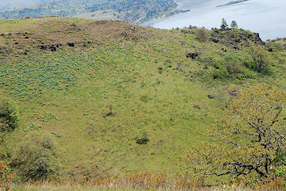
It will then take you through another sparse part of the woods and opens up to a marvelous view.
Keep following the trail. The creek will be down in the canyon to the left. It will bring you to another foot bridge. Cross it! After that, you'll reach another trail and you'll want to stay left, as Liz shows you.
This trail will take you toward private property to your right, so still hang a left. Another pretty view
Then, we took a look to see how far we'd come. We've come far.
After this, just keep following the trail. Later on, it will join up with another trail. Go through the fence and keep straight. You'll have people coming in from the right.
Then you'll meet up with more people and it will get slightly crowded...which is why we chose the most secluded. Just keep following and you'll end up back on road 8 on the trial head we passed. After that, take a right back to your car. I hope you enjoy the hike. It was a challenge, but a good challenge.


